
Paper published: 12-13-2019
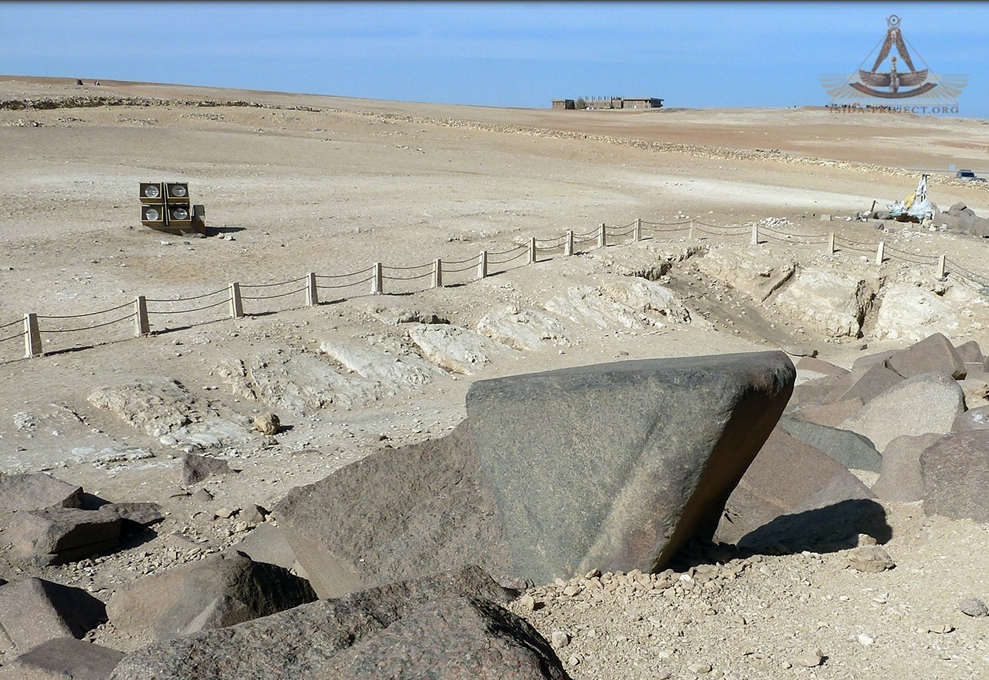
Image: View of the Menkaure quarry site location on the west side of the pyramid.
Source Image: https://isida-project.ucoz.com/
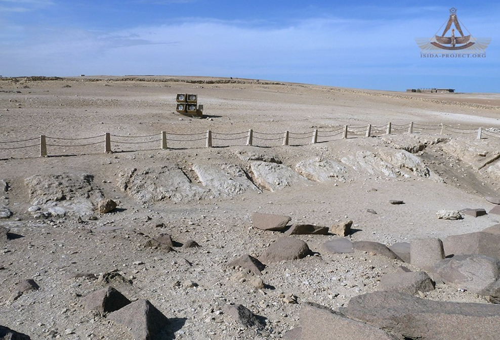
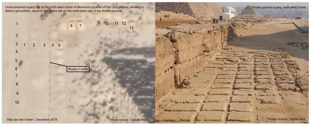
Image: Second image of the quarry site location north west corner of the Menkaure pyramid
Source Image: https://isida-project.ucoz.com/
Introduction
This post talks about the quarry field existing on the north western side of the Menkaure pyramid. It is further noteworthy that all 3 pyramids then have quarry sites on the north western corner due to the sloping Giza plateau perhaps. The other two where known as Mark Lehner has written about these in his book, but so far I have not found any documentation suggesting a quarry field on the north western side of Menkaure pyramid. Visual evidence seems to indicate this, but scientific onsite archeological research needs to determine the extend of this quarry field.

Hi there, I appreciate you reading my blog! 👀
The information presented here is free to read, with no ads. If you like this content, please consider supporting my writing by clicking on the link to become a member at Patreon Instead of a monthly recurring Patreon membership, you can also make a once off donation via Paypal or subscribe to my Youtube channel or follow me on X. 👇🏻


Thanks for your support!
Known quarry sites
There are numerous know quarry sites on the Giza plateau, for Khufu, Khafre and Menkaure. Menkaures known quarry site is known as the Menkaure quarry cemetery. This one is on the south western side.
Image: Menkaure Quarry Cemetry
Source: http://giza.fas.harvard.edu/sites/2029/full/
Quote: Menkaure (2490-2472 BC) built the third, or smallest, of the three principle Giza pyramids. American archaeologist, George Reisner, correctly identified a depression south-southeast of Menkaure’s pyramid as the quarry for that pyramid. It runs roughly southeast to northwest. Though we have not made a calculation of the volume, its size and location make it a likely candidate to be Menkaure’s pyramid quarry. Source: http://www.aeraweb.org/gpmp-project/great-pyramid-quarry/
Other known quarries on the Giza plateau is the quarry of Khafre on the north western side of Khafre pyramid.
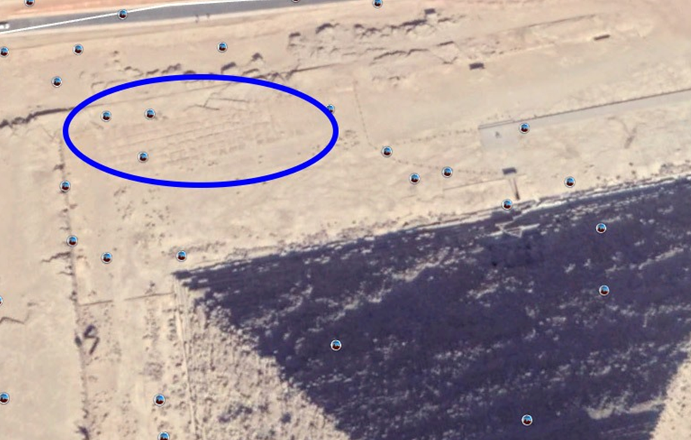
Image: Khafre pyramid showing the known quarry north west of the pyramid. As one can see these follow a distinct grid pattern.
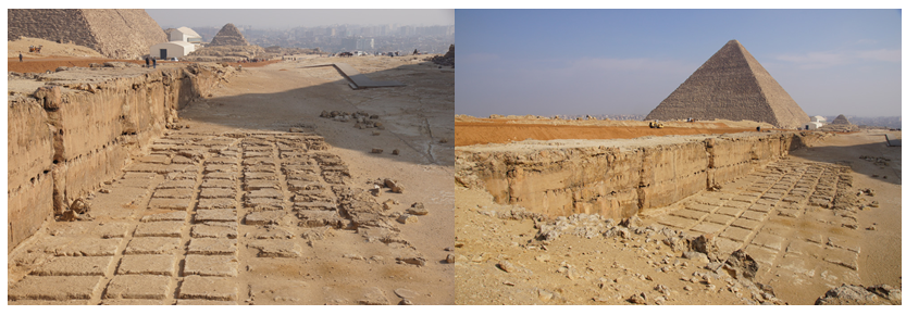
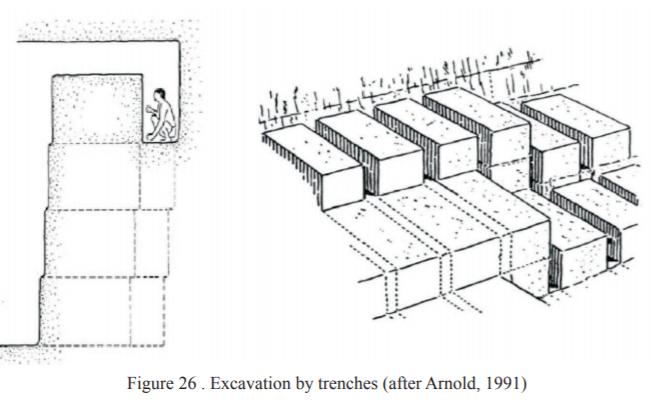
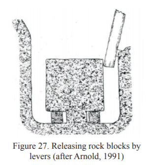
Methods of extraction that created this pattern
Dieter Arnold has written in his 1991 book, building in Egypt, Pharaonic Stone Masonry, about the methods used for these quarries. Below a visual artist impression. This makes it clear what leaves the “squares”.
Building in Egypt: Pharaonic Stone Masonry
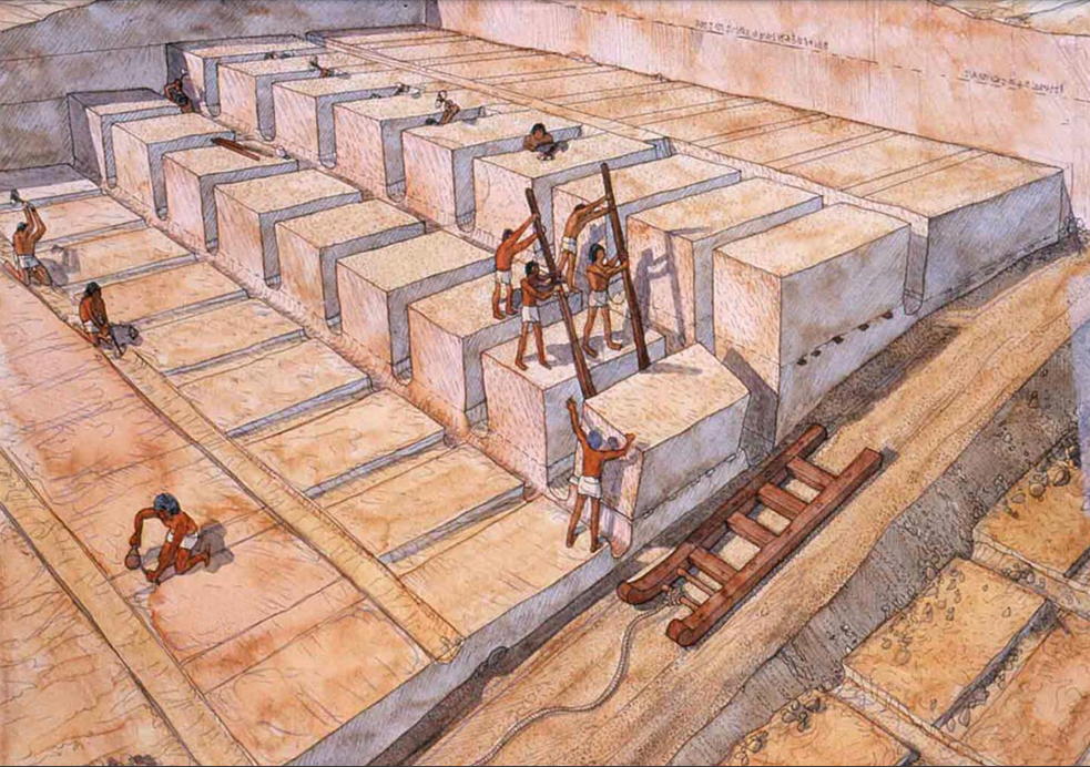
Image: Artist impression of a Giza quarry
Source: https://jeanclaudegolvin.com/project/egypte/egypte-gizeh-carrieres-jc-golvin/
The visual evidence for a quarry location north of Menkaure pyramid
At first the stones shown at the first image of this paper seem to be paving stones until one realizes that they do not join to each other and have wide channels carved in between them.
On google maps a faint but distinct grid pattern can be observed and if one knows where to look numerous pictures show this anomaly.
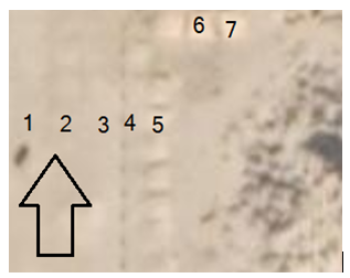
Image: A distinct grid pattern of rows and columns of square blocks is visible on google maps, which can not be observed in full from the ground.
Image Source: Google maps
Compared to the Khafre quarry grid pattern these now are unmistakably identical.
Hence the author suggests there is an undocumented and previously unknown quarry field present north west of the Menkaure pyramid. Whether this was because of the sloping of the Giza plateau, Mark Lehner said Khafre and Khufu pyramid both had quarried areas on the north western side.
Quote on Khafre pyramid: Like the Great Pyramid, a rock outcropping was used in the core. Due to the slope of the plateau, the northwest corner was cut 10 m (33 ft) out of the rock subsoil and the southeast corner is built up. Lehner, Mark (2008). The Complete Pyramids. New York: Thames & Hudson. ISBN 978-0-500-28547-3.
On another picture one can see a distinct rock outcrops corner was systematically quarried.
On the picture below one can clearly see the quarry area on the north western corner and it being part of, or on edge of the larger outcrop hidden under the sand.
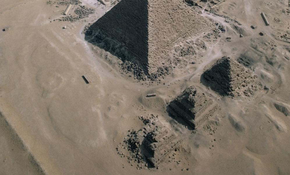
Image: Cropped from larger image
Source: Kazuyoshi Nomachi http://www.nomachi.com/g-ds-en.php?orderID=187
Whether the whole outcrop was a quarry or hill can only be checked by archeological excavations to determine the extent of the quarry area. As seen in an earlier picture already an area of 10 x 10 stones can be seen.
This could perhaps be further explored with onsite archeological research.
If you liked this research article please consider supporting the author, by scrolling down for various options, on the main page or sharing a link to this blog post or blog www.isutrikanda.com on your social media so others can also read it. You can also follow me on X @stijnvdhoven Thank you!
www.isutrikanda.com – IsuTrikanda – Copyright © 1999 – 2024 – All Rights Reserved.